What the Thomas Fire Left Behind
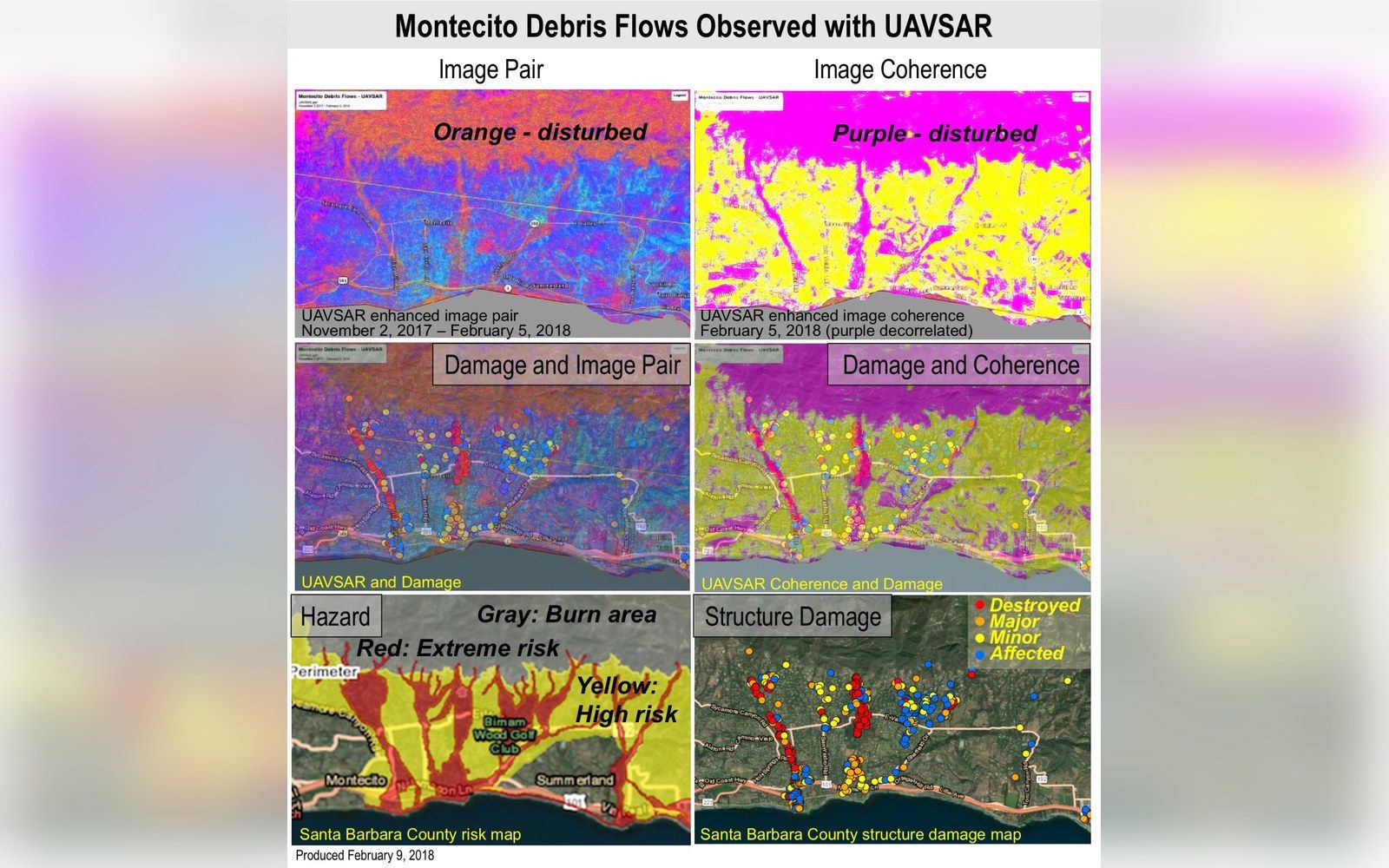
The Thomas Fire ignited in Ventura County on December 4, 2017, and burned northward and westward through the foothills above the Santa Barbara coastline for weeks before containment. By the time it was declared fully contained on January 12, 2018, it had scorched approximately 281,893 acres — at that moment the largest wildfire in California recorded history, a figure the California Department of Forestry and Fire Protection would later update as subsequent fires surpassed it. The burn scar above Montecito was the critical detail for what came next. Fire removes the deep-rooted chaparral that binds hillside soil; it also leaves a hydrophobic layer in the ground that causes rainfall to sheet across slopes rather than percolate through them. The Santa Ynez Mountains above Montecito were now a loaded mechanism.
On the night of January 8 and into the early morning of January 9, 2018, a Pacific storm delivered rainfall on the burn scar at rates that the National Weather Service recorded as exceeding half an inch in five minutes at certain gauging stations above the community. The result was a debris flow — a fast-moving slurry of water, soil, boulders, and uprooted vegetation — that descended through creek channels and spread across Montecito's streets. The Santa Barbara County Office of Emergency Services coordinated the disaster response as twenty-three people died and more than a hundred structures were destroyed or damaged. The 101 through Montecito, which runs in a narrow coastal corridor between the mountains and the sea, was buried under several feet of mud and debris across multiple lane-miles. Caltrans closed the highway in both directions on January 9.
Thirteen Days, One Road
The closure stretched from Cabrillo Boulevard in Santa Barbara south and east through the affected zone, cutting the primary coastal route between Santa Barbara and Ventura — and by extension, the Los Angeles basin — for thirteen days. Caltrans restored limited access in stages, with full reopening of US Route 101 occurring on January 22, 2018, according to Caltrans District 5 incident records. Thirteen days is not a long time in the abstract; in a corridor where the 101 carries roughly 200,000 vehicle trips per day through the Ventura–Santa Barbara segment under normal conditions, it was operationally significant at every scale from commuter to commercial freight to TCP carrier.
The detour routing was not complicated — there is, structurally, only one alternative for vehicles that must traverse the Santa Ynez Mountains without returning deep into the Central Valley. Highway 154, which climbs from Santa Barbara over San Marcos Pass at approximately 2,224 feet of elevation, descends through the Santa Ynez Valley past Lake Cachuma, and rejoins the 101 near Buellton, became the de facto bypass. Caltrans directed traffic accordingly. For passenger vehicles making that substitution, the practical addition was roughly forty to fifty miles and an hour or more of travel time compared with the direct coastal run. For commercial vehicles, the implications were more structural.
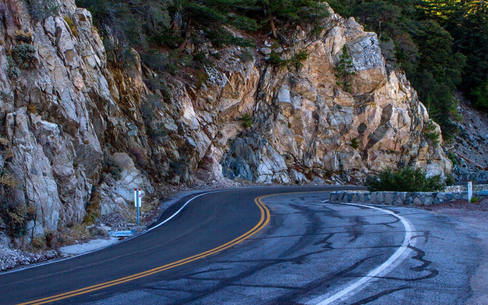
The Highway 154 corridor is a two-lane mountain road for most of its length over the pass. Its grade through the San Marcos Pass section exceeds six percent in places, its sight lines on the switchbacks are constrained, and it carries no shoulders adequate for a disabled commercial vehicle. The road is also subject to its own weather-related closures — fog, ice in winter, and rockfall — none of which suspended during the 101 emergency. When the 101 closed, Caltrans and the California Highway Patrol managed the resulting volume surge on 154 through traffic controls, but the road's geometry did not change. Operators running large vehicles — motorcoaches, stretch units, executive Sprinters — faced not just longer routing but a mountain road that imposes genuine physical limits on speed, overtaking, and recovery from mechanical incidents.

What the Detour Did to Commercial Scheduling
For TCP permit holders — charter-party carriers operating under California Public Utilities Commission authority — the closure created a cascade of scheduling problems that exposed how tightly timed most wine-country and airport runs already are. A carrier shuttling between Santa Barbara Municipal Airport and a property in the Santa Ynez Valley, under normal conditions, might route via the 101 north to the 154 junction near Buellton, or simply over the pass directly — total routing varying by origin. With the coastal 101 unavailable south of Santa Barbara, every airport-to-Los-Angeles run was rerouted, and deadhead economics deteriorated sharply. A driver completing a pickup at SBA and then repositioning to pick up a Los Angeles–bound client now faced not just distance but unpredictable transit times on a congested two-lane road.
Wine-country operators, whose revenue calendar in January is comparatively light, were somewhat insulated from the worst volume effects; the high-demand weekend bookings to the Sta. Rita Hills AVA or Ballard Canyon AVA that define spring and fall scheduling were not in full swing. But operators with standing contracts — fixed runs to the Chumash Casino Resort in Santa Ynez, for instance, or regular shuttle agreements with University of California, Santa Barbara — faced renegotiation of service commitments or had to absorb the time and fuel costs of the detour without corresponding fare adjustment.
Fuel cost is not a trivial variable on this corridor even in normal operations. The extension imposed by the 154 routing over San Marcos Pass — climbing and descending against grade in a loaded vehicle — increases fuel consumption meaningfully compared to flat coastal driving. A fully loaded executive Sprinter or Escalade ESV climbing the pass burns fuel at rates that operators who plan around coastal routing do not budget for. Repeated over thirteen days of operations, that differential accumulates. Operators with electric vehicles in their fleets faced an additional variable: Level 2 charging infrastructure along the 154 corridor is sparse, and the range mathematics for a full charter day on the rerouted circuit are less forgiving than on the 101 coast road, as the charging arithmetic on extended routes already makes clear.
The Record the Closure Leaves
Caltrans District 5's incident documentation of the January 2018 closure provides the closest thing to a commercial-impact baseline for what a prolonged 101 outage looks like in this corridor. The key finding for industry planning purposes is geographic: the 101 and the 154 are not equivalent routes. They serve the same origin-destination pairs only in the broadest sense. The 154 is slower, narrower, steeper, and less predictable in adverse weather — and it is the only road that connects the Santa Ynez Valley to the coast without leaving Santa Barbara County entirely. When the 101 closes, the 154 does not absorb the load; it is simply saturated with it.
The National Weather Service's post-event analysis confirmed that the rainfall rates that triggered the debris flow were within the range of events that can recur on burn-scarred terrain in subsequent winters. The Thomas Fire scar has since revegetated substantially, reducing immediate risk. But the structural vulnerability it revealed — a coastal highway with a single mountain-road alternate, running through terrain that burns and saturates on overlapping timescales — remains the physical reality of the Santa Barbara corridor. For every TCP carrier whose scheduling depends on the 101 running, thirteen days in January 2018 supplied the clearest available proof of what the backup plan actually costs.